

Yantai's Geography
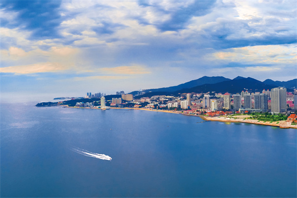
Yantai, located in the eastern part of the Shandong Peninsula, borders the Yellow Sea and the Bohai Sea, facing the Liaodong Peninsula as well as Japan, South Korea, and the DPRK across the sea. The terrain of Yantai is characterized by low mountains and hilly areas, with the Taibo Peak of Kunyu Mountain being the highest peak, which reaches an altitude of 922.8 meters. There are numerous rivers within the city. Seven rivers including the Dagu Jia River and the Wulong River possess a drainage area exceeding 1,000 square kilometers. Yantai boasts a coastline stretching 1,071 kilometers and 230 islands.
Yantai governs 5 districts, 6 county-level cities, and the national-level Economic and Technological Development Zone, High-tech Industrial Development Zone, Zhaoyuan Economic and Technological Development Zone, Comprehensive Bonded Zone, Kunyu Mountain Nature Reserve, and Changdao Marine Ecological Civilization Comprehensive Experimental Zone. There are 82 towns, 6 townships, 65 sub-districts, 599 urban communities and 5,386 administrative villages. The total area of the city is 13,900 square kilometers.
Yantai features a warm temperate continental monsoon climate. In 2023, its average precipitation was 646 millimeters, and its average temperature was 14 degrees Celsius, with 2,507 hours of sunshine and a frost-free period lasting 232 days.